Advanced search supports quotation marks as well as AND/OR statements to refine search. Example: "Hotel Jerome" OR "Jerome Hotel". To search the archive directly, please use https://archiveaspen.catalogaccess.com/advanced-search.
For more help or questions please visit our Photo Gallery Page for sizes, pricing and usage terms. You may also emailarchives@aspenhistory.org or call us with the Object Id Numbers at 970.925.3721.
Photo | Robert M. Chamberlain Collection
Map
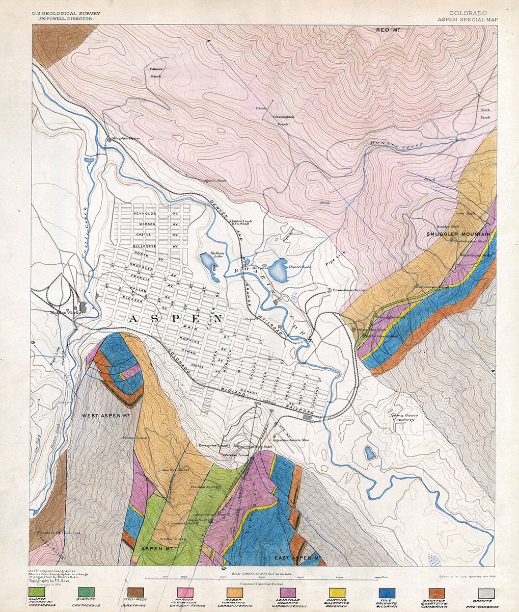
Geological Atlas of the Aspen Mining District, 1925
One 24" x 29" Geological Atlas. It was made to accompany a report on the Aspen Smelting Company in the Aspen Mining District, by R.T. Walker in October 1925. The atlas includes nine pages of maps, photos, and geological surveys. The first page has a map titled "Clason's Guide Map of the State of Colorado, which shows the entire state. The second page has a topographical map of the area around Aspen, with a mineralized zone highlighted in red. The third page has a map that shows a closer view of the area immediately surrounding Aspen, with different geological aspects highlighted in various colors. The fourth page has a map titled "Outline Map of Principal Mining Properties, Aspen Mining District". The fifth page has two b/w images; one look over Aspen towards Independence Pass, and the other shows Aspen from Smuggler Mountain, looking west. The sixth page has two identical photos of Smuggler Mountain; the top one has been shaded in various colors to show different geological formations. The seventh page does the same thing, but with images of Aspen Mountain. The eighth page has a map titled "Geological Sections, Aspen Mining District". The ninth page has a fold-out map titled "Longitudinal Section Along Ore Zone in Smuggler Mountain".
Aspen Historical Society retains all rights. Content for research and education purposes only. Permission to use any materials must be made in writing; use fees may apply.
")

